
|
MAIN RANGE NSW:
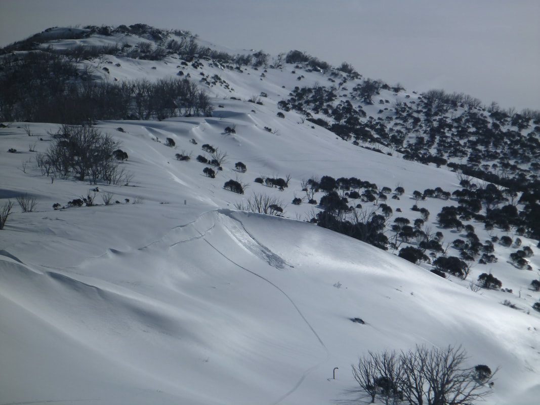
RECENT OBSERVATIONS UPDATED: 19TH / AUG /2018 REPORT CONFIDENCE: STRONG CURRENT UNTIL: 20TH / AUG / 2018 OBSERVATION SUMMARY TREND: DETERIORATING RECENT OBSERVATIONS CONSIDERABLE AVALANCHE DANGER. SUNDAY Field observations in today are of natural and skier triggered avalanches size 1 over the entire Main Range down to 35cm. Lots of new snow today falling at 2cm / hr. The lee slopes will have 3-5 times more loading so be care as slide are happening in these zones. Slides were triggered and witnessed on 25 deg slopes so even simple terrain is unstable ATM SATURDAY FIELD OBSERVATIONS Heavy snowfall today and continuing over the weekend . The new 30 cm of snow will be more like 50 by Sunday and this will be sitting on a melt freeze layer. Below this melt freeze layer is a touchy layer of buried surface hoar, so we could see large slabs on lee slopes. Snow falling to 900m on Saturday night so the whole Main Range will be getting some love from the snow gods. OUTLOOK This added weight on the snowpack will most likely see natural avalanches on steep loaded terrain. The Buried surface hoar below the 15cm of melt freeze will continue to be a issue moving forward so we will continue to monitor its bond strength. Stay in simple terrain and steer clear of terrain traps and natural hang fire while skiing and touring. Enjoy the touring on the weekend and stay safe.
1 Comment
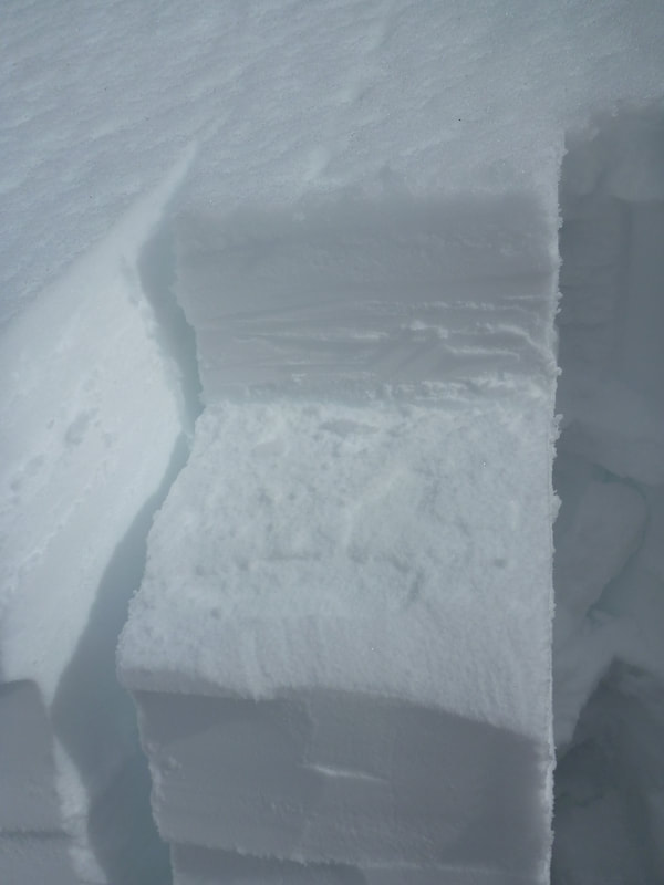
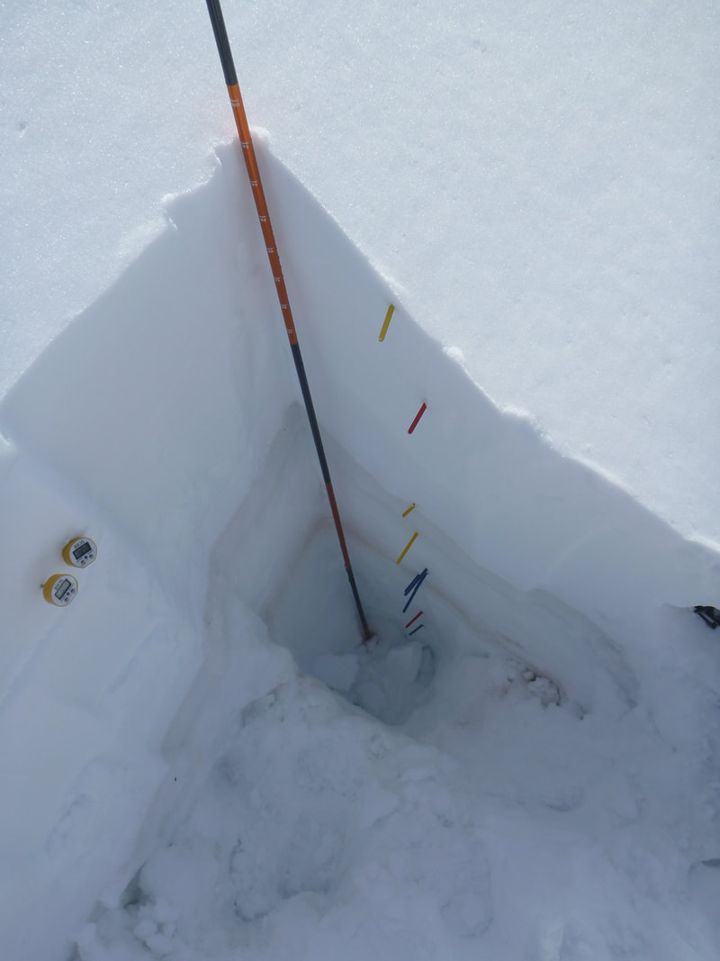
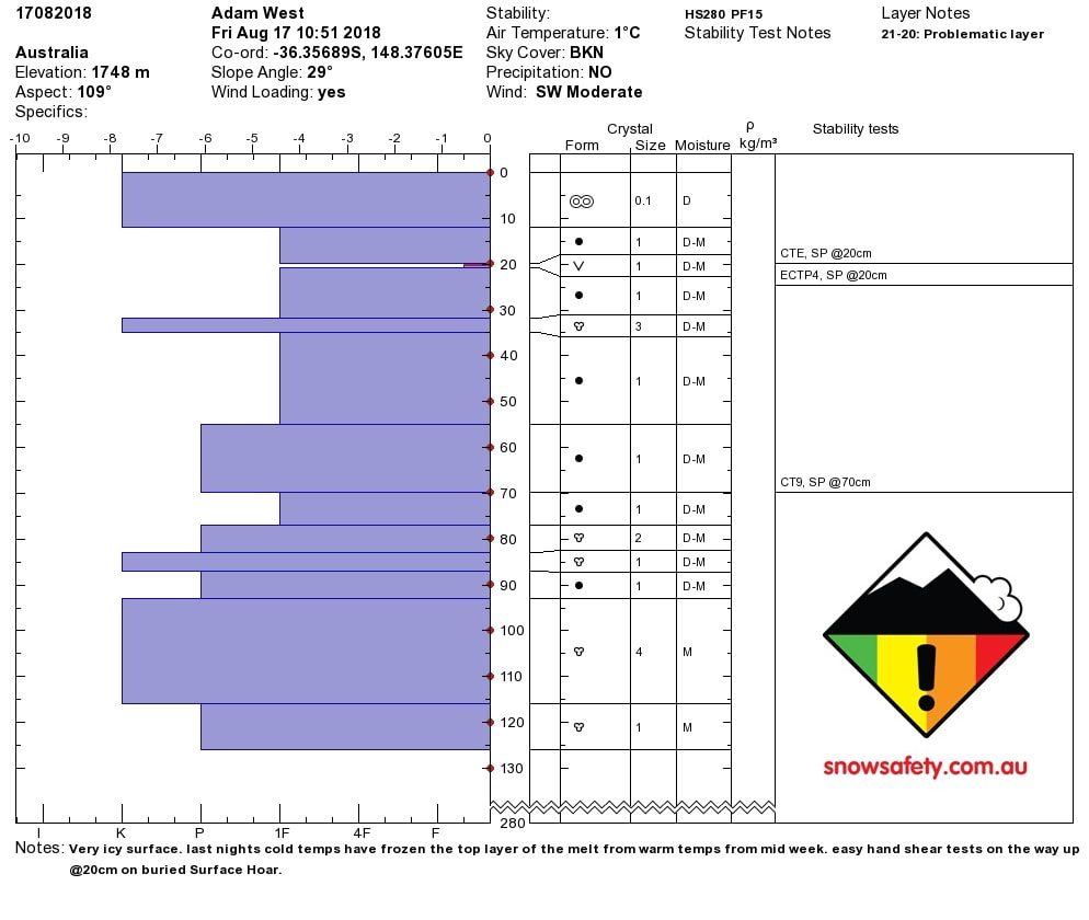 FIELD OBSERVATIONS There is a heavy melt freeze crust on the surface (@11am) and doesn't look to soften with the colder daytime temps forecast today and for the weekend. Stormy weather rolling in as obs were being done. East CT results and easy ECT results @20cm on buried Surface Hoar. CT9 @70 cm as well on hardness change on Rounds. There is forecasted snow coming in the PM today and continuing all weekend so it will be interesting to see if the new snow will bond to the melt / freeze crust . OUTLOOK There is a large storm due to in the PM today. This added weight on the snowpack will most likely see natural avalanches on steep loaded terrain. The Buried surface hoar below the 15cm of melt freeze will continue to be a issue moving forward so we will continue to monitor its bond strength. Stay in simple terrain and steer clear of terrain traps and natural hang fire while skiing and touring. Enjoy the touring on the weekend and stay safe.
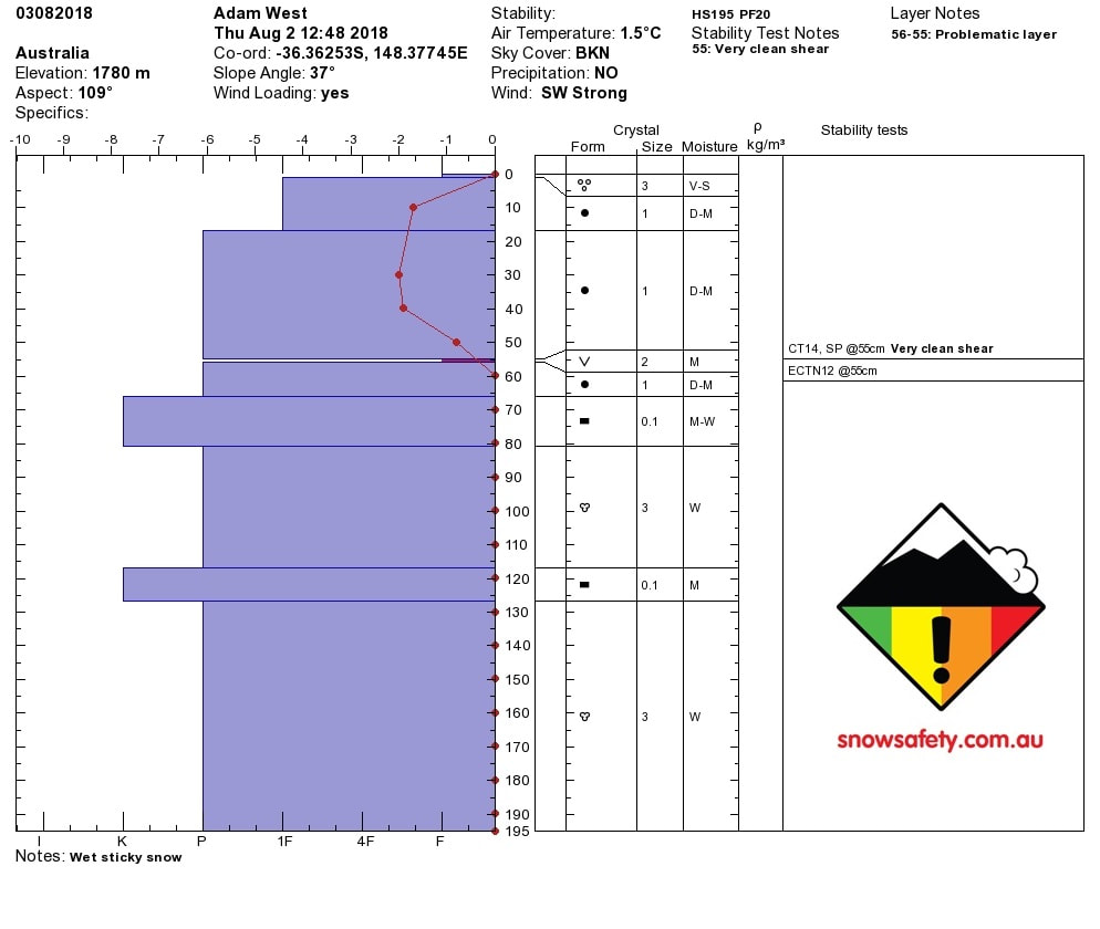
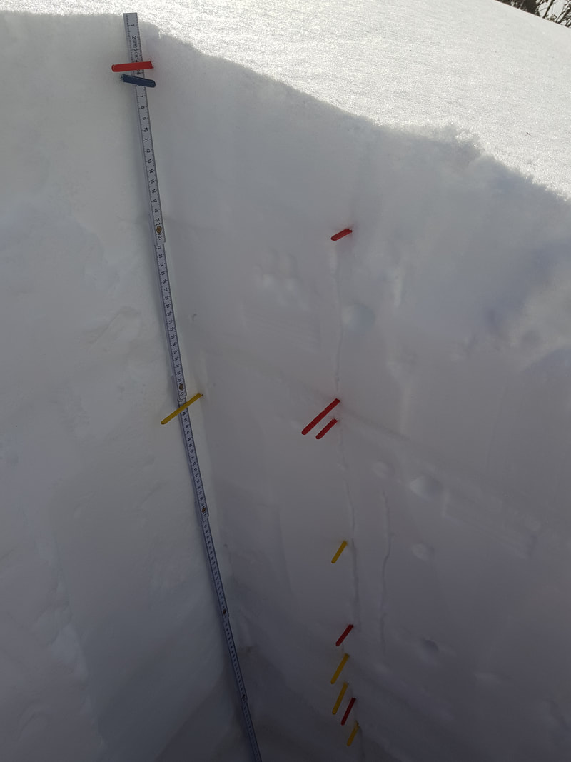
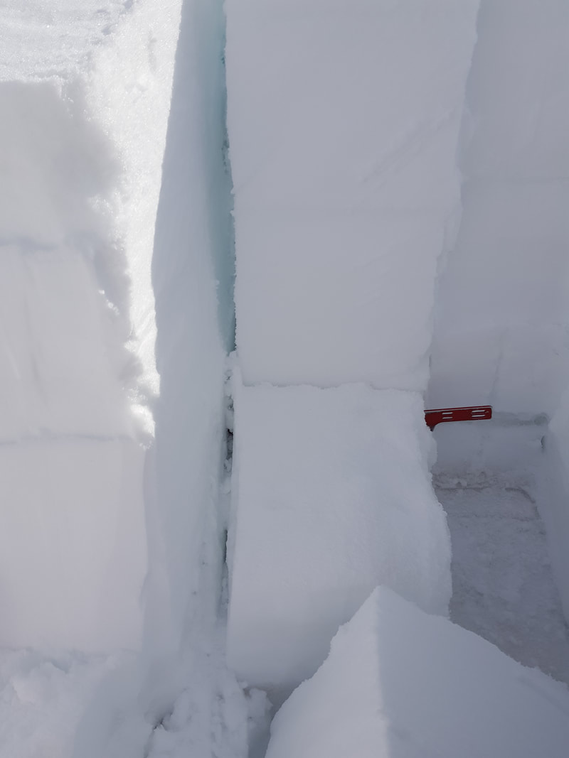
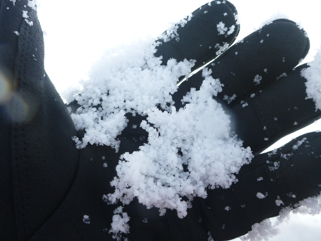
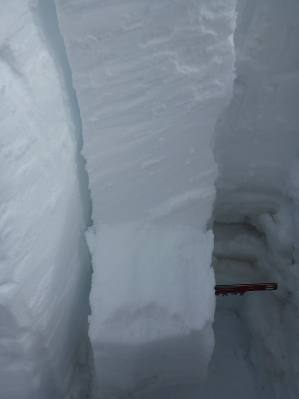
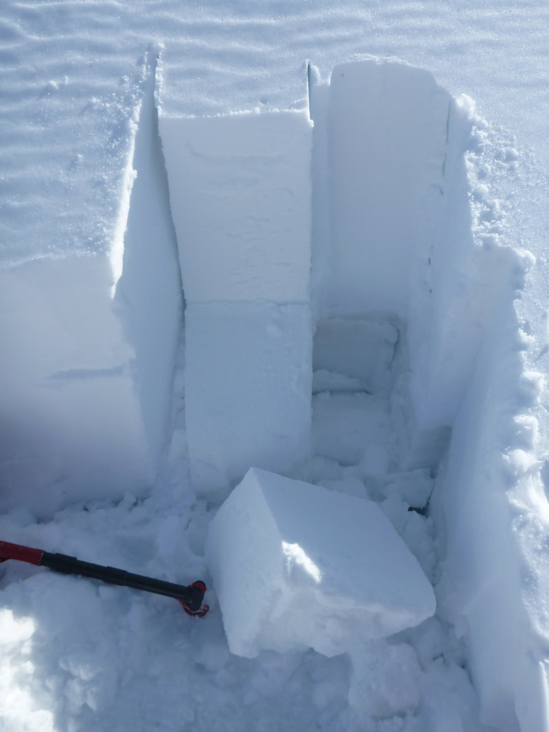
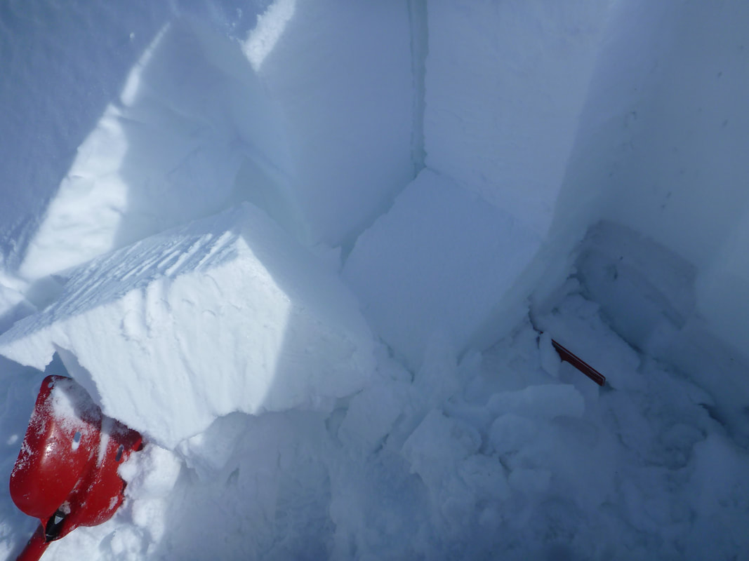
 FIELD OBSERVATIONS The landscape has changed with the last storm. 30-50cm of snow has fallen and the backcountry has a nice new layer of powder snow on it. The Snow continued late on Sunday and was falling at 1cm / hr in the PM. We had easy results on Hand shear and compression tests. CTE4SP@15cm on buried surface hoar. CTM16SP@31cm on buried surface hoar. CTH24SP@84cm on buried graupel. This deep result has changed since Friday when it was only collapsing, now its planar shearing. This deep persistent weak layer @84cm could be a concern on steep terrain so be careful on lee to the SW on slopes over 35 deg. OUTLOOK There is a large storm due to hit late Tuesday night. This added weight on the snowpack will most likely see natural avalanches on steep loaded terrain as the buried surface hoar will be very touchy. Stay in simple terrain and steer clear of terrain traps and natural hang fire while skiing and touring. Let this storm cycle move through and enjoy the touring on the weekend. 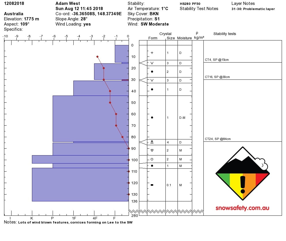 FIELD OBSERVATIONS The temps have be warm over the past few days. There is a melt freeze crust on the the surface and 60cm of new snow under that. That new snow is sitting on a 5cm layer of graupel sitting on a solid melt freeze layer from the last rain event. in that 60cm new snow layer there is buried surface hoar @20cm. We got CTE 2 SP @20cm on buried surface hoar. We also got CTE 9 SC @61cm on the buried graupel. No results from deep tap test . We also got a ECTP 3 @ 20cm on the buried surface hoar. This means that we will have propagating slabs in the backcountry on loaded lee aspects on steeper terrain. OUTLOOK There is a large storm due to hit late Friday night but will start with rain and then turn to snow. Fingers crossed this bonds well to the melt / slush layer from today's warm temps. This added weight on the snowpack will most likely see natural avalanches on steep loaded terrain as the buried surface hoar will be very touchy. Stay in simple terrain and steer clear of terrain traps and natural hang fire while skiing and touring. Let this storm cycle move through and enjoy the touring early in the new week. 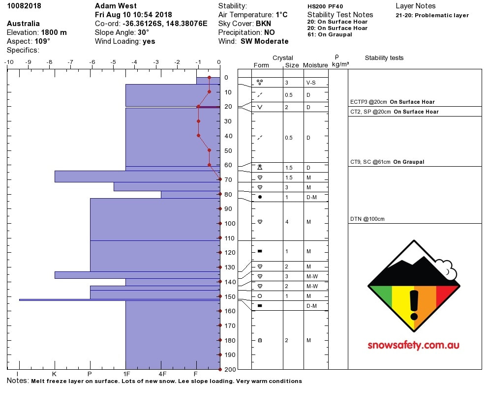
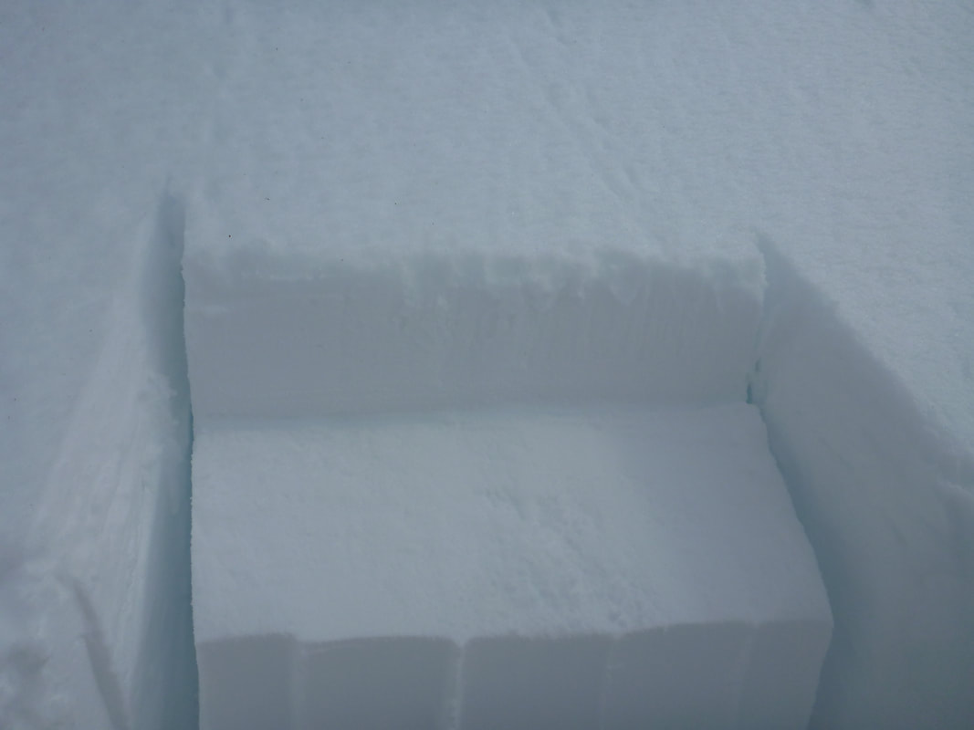  THURSDAY Temperatures have fallen overnight and there was a large frost this morning. Winds have shifted from SE to SW and have increased. This is the beginning for the new front that will drop an estimated 30cm of precipitation over the weekend starting Friday. The top layer of the snowpack is wet, but the layers from the past week have bonded well. FRIDAY There is a strong temperature gradient in the top 60cm of the snow pack which wasn't there on Sunday. There is a persistent weak layer @55cm that is gives moderate sudden planner results. ETC didn't propagate as expected but there was a partial break on the same problematic layer at 55cm. If on steeper lee slopes this weekend remember that that layer may slide and it will be a slab about 50-60cm in size. OUTLOOK: There's some big winds and then more snow, following tomorrows mini blizzard that will see the accumulation for 48hrs hit 30cm. Yellow flags... Temps are low, the freezing level is low thanks to a big bump from the south. Weekend snow play will be fun with more new snow landing. As per normal the wind will play a huge role in where the decent skiing / boarding will take place so pick you lee slopes and have fun.
|
Archives
March 2022
AuthorSnow Safety Australia is a NSW based information website. Categories |

 RSS Feed
Training Courses |
Company |
|